- አማርኛ
- English
Languages:
This site is created using Wikimapia data. Wikimapia is an open-content collaborative map project contributed by volunteers around the world. It contains information about 32658096 places and counting.
Learn more about Wikimapia and cityguides.
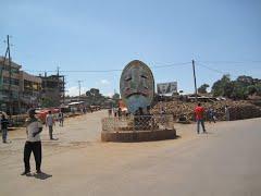
Agaro
"Agaro is a town in southwestern
Ethiopia, and the administrative
center of Gomma woreda."
Wikipedia article: http://en.wikipedia.org/wiki/Agaro
Agaro on the map.
Recent city comments: